HowTo Geolocate Network Packet Capture Data
Overview
This HowTo explains the procedure for geolocating IPv4 Address Conversations using the NST WUI and rendering the results on either a Mercator World Map projection or on a KML Earth Browser such as Google Earth, Google Maps or Marble.
There are a couple of items to consider prior to starting IPv4 Address Conversations geolocation. First, does the network packet capture make sense to use for geolocation. The list below are packet capture characteristics that would not be considered desirable for geolocation:
- No IPv4 Addresses exist in the capture file. Results: No geolocations would be rendered.
- All hosts in the capture file are located at the same physical location. Results: Geolocations would appear at a single point.
- All hosts are Private IP Addresses with no associated geolocation database information. Results: No geolocations would be rendered. Note: This condition can be corrected, see section: IP Geolocation Database & Adjustments.
Secondly, has a geolocation database been configured for your NST probe. This includes the addition of configuring any Private IPv4 Addresses or Network geolocation information, see section: IP Geolocation Database & Adjustments.
IP Geolocation Database & Adjustments
Make sure that a geolocation database has been configured for your NST probe prior to attempt to use IPv4 Address Conversations geolocation. Use the ' IP Geolocate Configure' button shown below to manage the global geolocation policy for the NST system. This allows one to make latitude and longitude coordinate adjustments, configure Private IPv4 Addresses & Network coordinate locations and select a geolocation database source. In addition, one can also download and manage the MaxMind "GeoIP Country Edition", the enhanced "GeoIP Lite City Edition" and the "GeoIP AS Number Edition" data sets.
Geolocate IPv4 Address Conversations
Geolocation: Map & Network Packet Capture Decode Settings
Both the NST WUI Single-Tap and Multi-Tap Network Packet Capture implementation support the ability to geolocate an IPv4 Address Conversation List derived from a tshark decode. Once a capture file is available for decode analysis, you can then perform IPv4 Address Conversation List geolocations. The caption below shows the Text-Based Protocol Analyzer Decode section for the Single-Tap Network Packet Capture implementation with the Advanced Decode Protocol Analyzer Options folder expanded. One can use the "Conversations - World Map" button to render IPv4 Address Conversations on a Mercator World Map bit image or the "Conversations - KML" button to render the IPv4 Address Conversations on an Earth Browser like Google Earth.
Geolocate Mercator World Map Conversation List Options
The following options are available when generating an IPv4 Address Conversations Mercator World Map:
- Mark Type: Select either a "point", "plus sign" or a "star" as the marker symbol.
- Mark Color: Select the marker symbol color from a set of predefined colors.
- Connect Conversation Lines: If selected, a line between each conversation host endpoint will be drawn. If unselected, just plot the hosts that can be geolocated from the network packet capture.
- Conversations Annotation: Use this text field to describe the IPv4 Address Conversations Mercator World Map. If omitted, the capture note associated with the capture file will be used.
Geolocate KML Conversation List Options
The following options are available when generating an IPv4 Address Conversations KML document for rendering on Google Earth:
- Conversation Line Width: Select a fixed conversation line width from 1 to 10 pixels. One can also select the value: "graduated" to set each conversation line width based on the total sent and received network traffic for the conversation.
- Conversations Annotation: Use this text field to describe the IPv4 Address Conversations KML document. If omitted, the capture note associated with the capture file will be used.
Geolocate tshark Decode Conversation List Options
The following options are available when geolocating an IPv4 Address Conversation list using the tshark Protocol Analyzer.
- Name Resolve: Provide network name resolution for each host in the capture file.
- tshark Display Filter Expression: Apply a display filter to isolate or limit the amount of network traffic to geolocate.
- Advanced Decode Options: Use an advanced decode preference option like: "-o ip.use_geoip:TRUE" to allow geolocate display filter expressions (e.g., ip.geoip.lat > "23.5").
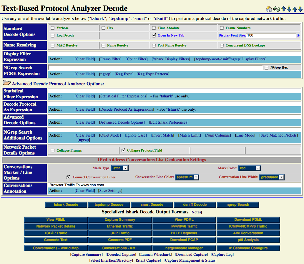
The screen shot below shows the tool tip for the "Conversations - World Map" button located in the "Specialized tshark Decode Output Formats" section.
Mercator World Map
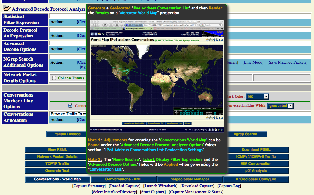
Use the "Conversations - World Map" button to start the process of generating IPv4 Address Conversations on a Mercator World Map bit image. A Progress Generation page similar to the one shown below will be displayed during the course of creating the entire bit image.
One has some control during the generate process to "Hold", "Cancel" or "Continue". One can also use the "View Generate Log" to see all commands and log output for geolocating IPv4 Address Conversations on the Mercator World Map projection.
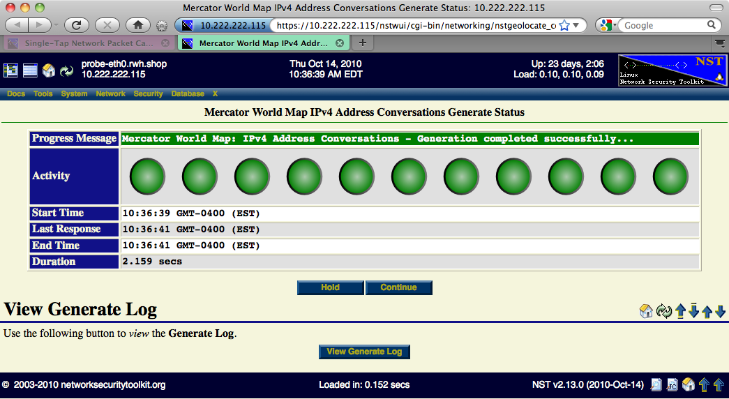
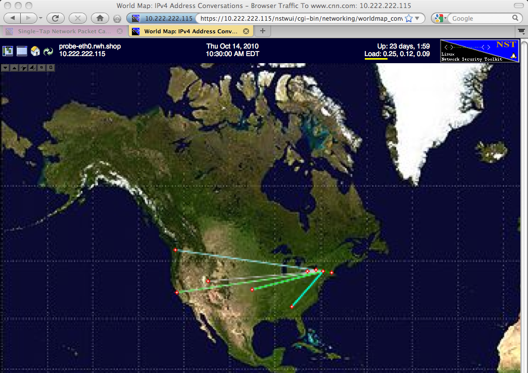
Once completed, the Progress Generation page will be replaced with the final rendering of IPv4 Address Conversations on a Mercator World Map projection similar to one one shown below. A total of "21" IPv4 Address Conversations and "22" Hosts were geolocated.
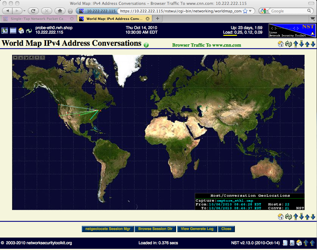
Use the "Image Control Button Grid" to maneuver and/or zoom the map within your browser window (See page: World Map Image Control Button Grid for details). The map below was zoomed in and center positioned over the North American Continent to better illustrate the geolocated IPv4 Address Conversations.
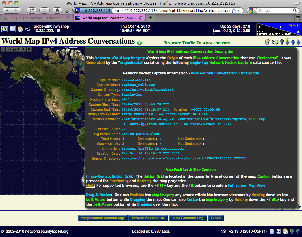
The map below was generated using the same network packet capture but a tshark display filter was used to limit the number of packets processed. Hover the mouse pointer over the "Information Icon" to reveal detailed capture file configuration settings, the tshark command with display filter use to generate the IPv4 Address Conversation List and the geolocation results.
KML Document
Use the "Conversations - World Map" button to start the process of generating an IPv4 Address Conversations KML document that can be rendered on a KML Earth Browser such as Google Earth. A Progress page will first appear during the creation of the KML document which can take some time depending on the number of conversations to geolocate. Once the document has completed, you can view it in Google Earth (See the HowTo document: HowTo Setup Your Client System To View Geolocation Data).
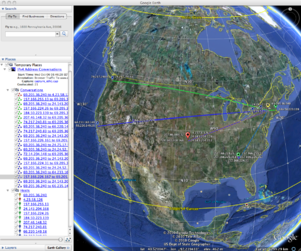
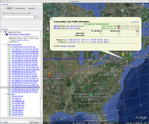
Each IPv4 Address Conversation geolocated will appear as a Great Circle between each conversation host endpoint. Each conversation Great Circle contains a 'Conversation Description' balloon depicting network traffic statistics information. Click on a Great Circle to reveal the 'Conversation Description' balloon. Each conversation host endpoint marker also contains a 'Host Description' balloon depicting network traffic statistics information. Click on a host marker to reveal the 'Host Description' balloon. Hyperlinks are also provided to the ntop (Host Collector) user interface and to one or more NST WUI 'IP Tools' pages for additional network processing using the host's IP Address.
 |
 |
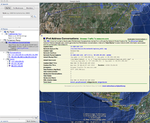 |
When using Google Earth, one can also view the 'Document Description' balloon by clicking on the generated KML ntop Hosts place found under Temporary Places within the sidebar on the left-hand side. You can also expand the ntop Hosts place to explore all geolocated hosts and associated network statistics.